
Map Annotations Integration
Descartes Systems Ltd.
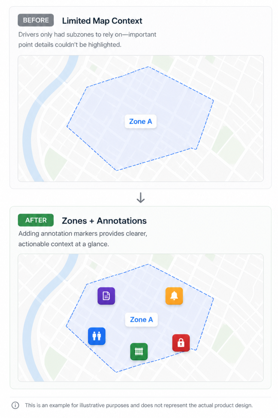
Problem
Following an acquisition, we needed to integrate a separate annotations feature into an existing subzones system without adding clutter or reducing map clarity for drivers.
Users
Primary: Drivers navigating routes in real time
Secondary: Dispatch teams configuring map data
Improved clarity • Better driver decision-making
Goal
Enhance map usability by introducing clear, location-specific markers while maintaining a clean and readable experience.
My Approach
Drove design discussions focused on real-world driver usability
Suggested marker types and visual patterns to improve clarity
Ensured accessibility through high colour contrast and icon visibility
Defined tickets and acceptance criteria for implementation
Demoed progress to align stakeholders and communicate value
Impact
Improved map readability and clarity for drivers navigating complex routes
Enabled richer, more flexible map context through combined zones + markers
Increased confidence in map-based decision-making during operations
Tradeoffs
Limited the number of annotation types in the initial release to avoid clutter
Prioritized clarity and contrast over customization flexibility
Balanced adding detail with maintaining a simple, scannable map
Takeaway
Adding features to an existing system isn’t just about capability—it’s about making sure new functionality enhances clarity rather than creating noise.
Like what you see? Let’s talk ☕